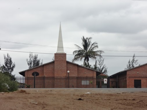
Church nearby Comunidade Santos Anjos
Mozambique
Church nearby Comunidade Santos Anjos
Comunidade Santos Anjos
Boane, Mosambik
contacts phone
:
+258 84 750 2088
Latitude:
-25.9617621
, Longitude:
32.4154937
larger map & directions
read more
nearest Church
1.855 km
Igreja Baptista de Djuba
Djuba, Matola-Rio
Church
read more
2.578 km
Comunidade José Allamano
Matola
Church
read more
3.369 km
Igreja Baptista de Matola-Rio
Matola-Rio
Church
read more
4.246 km
Seminário prepedêutico Cristo-Rei
Matola
Church
read more
4.257 km
Paróquia são Gabriel arcanjo
Matola
Church
read more
4.508 km
Salão de Assembleias das Testemunhas de Jeová
Matola
Church
read more
4.54 km
A Igreja de Jesus Cristo Dos Santos Últimos Dias
EN4
Church
read more
4.935 km
Lewende Gemeente Maputo/Living Congregation
Mozambique
Church
read more
5.087 km
Paroquia Nossa Senhora Do Amparo
Avenida da Liberdade, Matola
Church
read more
5.253 km
UCKG
Mozambique
Church
read more
5.509 km
Igreja Presbiteriana de Moçambique - Paróquia da Matola
Mozambique
Church
read more
5.874 km
Igreja Matola Santos
santos, Matola
Church
read more
6.326 km
Embaixada De Cristo, Matola
Matola
Church
read more
6.611 km
Paróquia São Baptista do Fomento
Matola
Church
read more
8.152 km
Liberdade Methodist Church
Matola
Church
read more
8.369 km
Igreja Evangélica Assembleia De Deus
Tsalala
Church
read more
9.558 km
Igreja Adventista Do Sétimo Dia Da Machava Socimol
Matola
Church
read more
12.048 km
Tsalala Church
Unnamed Road
Church
read more
13.953 km
Evangelical Church Assembly of God
Church
read more
14.153 km
Kirche Jesu Christi der Heiligen der Letzten Tage
Matola
Church
read more
14.18 km
Igreja Católica da T-3
Av. 4 de Outubro
Church
read more
14.199 km
Malanga United Methodist Church
Avenida 24 de Julho, Maputo
Church
read more
14.671 km
Igreja Baptista do Alto Mae
Avenida do Rio Tembe, Maputo
Church
read more
17.13 km
New Apostolic Church Paraiso
Matola
Church
read more
18.069 km
IASD-Khongolote
Matola
Church
read more
📑
all categories
Accounting
Administrative area level 1
Administrative area level 2
Airport
Amusement park
Art gallery
Atm
Bakery
Bank
Bar
Beauty salon
Bicycle store
Book store
Bowling alley
Bus station
Cafe
Campground
Car dealer
Car rental
Car repair
Car wash
Casino
Cemetery
Church
City hall
Clothing store
Convenience store
Courthouse
Dentist
Department store
Doctor
Electrician
Electronics store
Embassy
Finance
Fire station
Food
Funeral home
Furniture store
Gas station
General contractor
Grocery or supermarket
Gym
Hair care
Hardware store
Health
Hindu Temple
Home goods store
Hospital
Insurance agency
Laundry
Lawyer
Library
Liquor store
Local government office
Locality
Lodging
Meal delivery
Meal takeaway
Mosque
Movie theater
Moving company
Museum
Natural feature
Neighborhood
Night club
Park
Parking
Pet store
Pharmacy
Place of worship
Point of interest
Police
Post office
Premise
Real estate agency
Restaurant
Roofing contractor
Route
School
Shoe store
Shopping mall
Spa
Stadium
Storage
Store
Supermarket
Taxi stand
Train station
Transit station
Travel agency
University
Veterinary care
sublocality level 1
↑